Slide Background
high performance
airborne lidar solutions
ELMAP-H
Slide Background
high performance
airborne lidar solutions
ELMAP-V
Slide Background
High Performance
Airborne LiDAR Solutions
previous arrowprevious arrow
next arrownext arrow
Airborne Lidar Solutions
Hardware

High - Performance

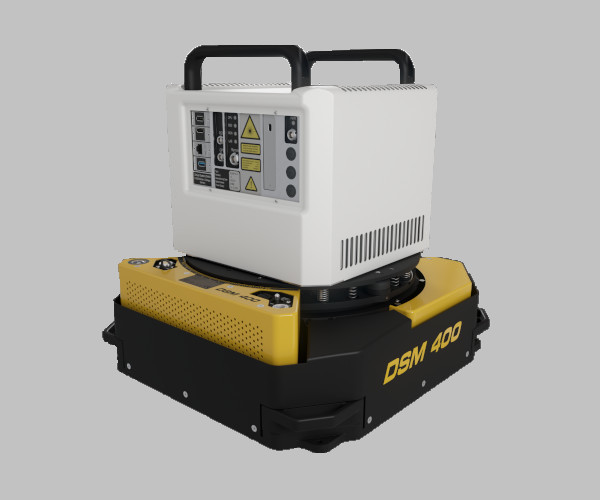
ELMAP-H

ELMAP-H Airborne LiDARs

A series of compact, high-performance laserscanners designed for cost-effective airborne laser mapping with fixed-wing aircraft, helicopters, gyrocopters, and large-payload UAVs.

REQUEST A QUOTELEARN MORE
Hardware

High - Performance

ELMAP-V

ELMAP-V Airborne LiDARs

The new ELMAP-V Airborne LiDARs are high-performance laserscanners designed specifically for installation on aircraft with small camera parts and in stabilizing platforms.

REQUEST A QUOTELEARN MORE
Software

Desktop application

GEOCODE SOFTWARE

Geocode is an easy-to-use software tool for processing the raw waveform data collected by ELMAP laser scanner systems and converting it into geocoded point clouds in a map-projected coordinate system. The data can be output in different formats, such as customized ASCII, TerraScan BIN or LAS. Normalized waveform data is also available for advanced post processing requirements.

Geocode is bundled with the ELMAP LiDAR’s and is therefore a standard delivery item.

What Our Customers Say About Us

Discover the Voices Behind Our Success – Real Stories, Real Experiences. See What Our Customers  Are Saying About Their Journey with GeoLas Systems. Your Trust, Our Commitment.

PRIMARY
APPLICATIONS

PRIMARY APPLICATIONS

wide-area mapping

Infrastructures & corridors

Mountainous terrain

Agriculture

Forestry

Mining

Urban-areas

Ice sheets and glaciers

Coastal Monitoring

Power Lines

Productivity

Elevate Your Efficiency and Achieve More with ELMAP LiDAR systems….

LEARN MORE
DATA
SAMPLES

Data Samples

Dive into our Data Samples Section to explore curated snippets showcasing the richness and depth of information we provide. Experience a glimpse of the valuable insights and patterns hidden within our datasets, illustrating the potential for informed decision-making.

Explore, analyze, and envision the possibilities that await in the world of data with GeoLas System.

CONTACT US FOR MORE DETAILS

Features & Benefits

Dive into the ELMAP features and benefits section and learn more about…….

LEARN MORE

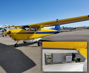
Installation examples

instalation

OPTIONS

Tailor your surveying solutions with cutting-edge technology designed for accuracy and efficiency. Take your mapping projects to the next level with our solutions.